the Escapades of Dr. Amy
Day-hiking the Appalachian Trail- Day 1
I’m finally ready to begin the adventure of hiking the Appalachian Trail. I’ve read many books written by others who’ve accomplished this feat. Frankly, their experiences sounded rather uncomfortable. I don’t want to be dirty, have to poop in a hole, or sleep on the ground. I want to hike the Appalachian trail glamping style. That is, I will day-hike the trail.
Once I had this idea, I wasn’t sure where to start. I read books on day hiking and finally found a plan.
I decided that my first hike should be easy. I picked a 2-mile hike to metaphorically get my feet wet. My husband decided to join me, and we drove to the trailhead on Route 42. Let me tell you, navigating that narrow and windy road was the start of our adventure. My husband had a death grip on the ceiling handle. I teased that if we went off the side of the mountain, that handle wouldn’t do much for him.
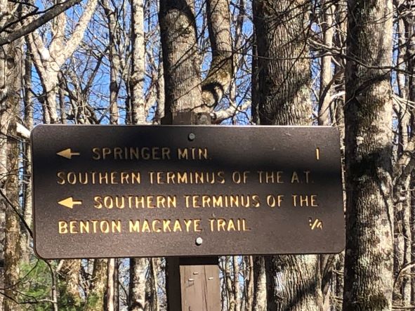
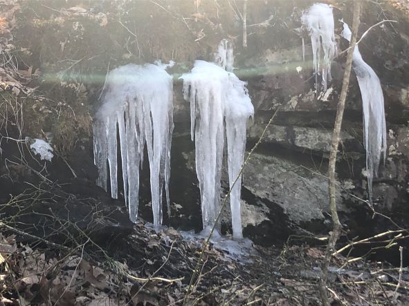
At the trailhead, we located signs pointing to the Appalachian trail and the Southern Terminus. I checked and rechecked my detailed directions and the trail seemed easy to navigate. This was a pleasant spring day following some snowstorms. The snow had melted, and the trail was rather muddy, but not too slippery. There were still some icicles on the edge of the rocks. My book made note of the Springer Mountain Shelter. When I saw the sign for the shelter, I thought we should go that way. A nice hiker noticed us heading off the main trail and made sure we intended to do this. He pointed behind him. The platform is that way. If I haven’t mentioned, I can be a bit directionally challenged. Even on a simple path, with directions, I am prone to getting lost.
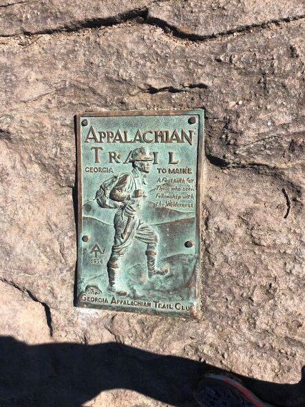
Despite my geographical disorientation, we made it to the platform marking the southern terminus of the Appalachian Trail. There were a bunch of experienced-looking hikers at that spot. They were resting and eating. I surmised that they started at Amicalola Falls about 8 miles away. I searched for the next section of the trail, entered the clearing, and went in circles. I couldn’t find the trail. I felt a little intimidated among the experienced hikers but knew we had to get directions. One of the hikers pointed back the way we had come. “Follow the white blazes”, he said. I then realized that we had been on the trail the whole time.
We turned around and went back the way we came. This time, noticing the white blazes. We actually did divert to look at the Springer Mountain Shelter on the way back. We saw a sign with an arrow toward the Privy. “What’s a privy?”, we asked each other. We saw a structure with 3 sides and an opening. This must be the shelter, providing partial protection from the elements. I wanted to look inside and take a picture. Then I saw the toilet overflowing. Oh, a privy. Like an outhouse? No pictures taken thank you. We returned to the original trailhead and located the next part of the trail leading to 3 forks about 3 miles away. We decided to leave that section for our next adventure.
Today, I hiked about 1 mile of the Appalachian Trail. I would love to complete the trail with a series of day hikes. I realize this could take years to forever, but we made a great start.

